
Park City to Provo - 65 miles in 4 days

The idea for this hike was actually hatched a couple of years ago when we moved into our home in Provo. Given the proximity it has with Slate Canyon and the Bonneville Shoreline Trail and the proximity of my in-laws home to the Wasatch Crest Trail in Summit Park, I had speculated about the possibilities of a route between their home and our home. I thought it would be fascinating to see if one could go from either of our doors to the other without following a road for any extended distance. The middle section and majority of the route would follow trails that are part of the Great Western Trail. The biggest question marks were finding a route from my in-law's home near the top of Summit Park to the Wasatch Crest Trail and getting across Provo Canyon in a safe and efficient manner.
Well, this past spring, I got really serious about this particular trip and began to seek answers to the two question areas. I studied Google Earth/Maps quite a bit and began to mark up a route using CalTopo. For the Summit Park end, I was happy to find what looked like a path that led from the Wasatch Crest Trail atop of The Canyons resort, around Murdock Peak, through Toll Canyon, and up into the network of trails between Summit Peak and Summit Park. I was extra excited to find that what was once a private conservation area, Toll Canyon had also been purchased for public use over this past year.
For the Provo Canyon question, I found that Google Maps had a trail marked through Pole Canyon between Hope Campground along the Squaw Peak Road and the Bonneville Shoreline Trail near Bridal Veil Falls.
I scouted both areas out this past spring and confirmed the trails through said areas to be in good shape. Of course...this was when vegetation was low.
Now armed with some lighter weight gear and systems and a better fitting and more comfortable pack, I had circled a week in mid-June to set out on this trek. I had picked June because I was confident that the snow would be melted out enough at the passes between Big Cottonwood, Little Cottonwood and American Fork Canyons but still not be so hot when hiking at the lower elevations. Knowing that I'd have a cell signal along the majority of the route and that much of the trails were high traffic trails, I was going to go solo. Well, the day before I was to begin, an abnormal cold front hit Northern Utah bringing with it a snow storm that put down 6 inches of snow across the upper mountains.
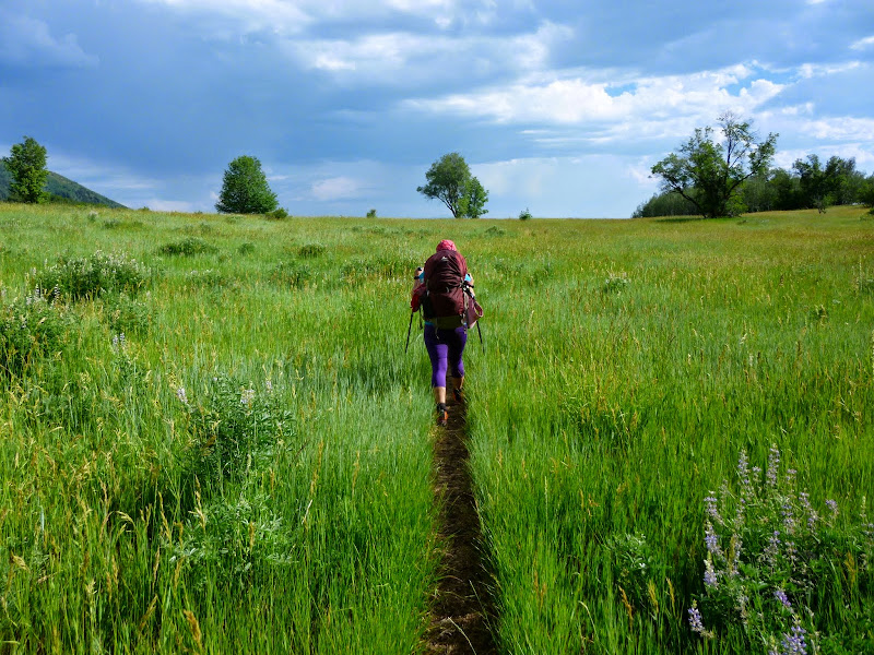
Disappointed, and having already taken some vacation days off for the trip, I wondered if I'd get another shot at it this year or have to put it off another year. My wife, Jess, and I had circled some time in July to go up to Kings Peak and/or Red Castle in the Uintas. Jess thought about it and then said she was willing to give up the Uintas this year because they'd always be there, and that she'd be willing to accompany me on this route since her parents will likely be selling off their place in Summit Park and retiring to their place in Torrey in the next year or two.
Despite the distance that would be required each day to complete this trek, she committed to the challenge. In some ways, it would be an even more meaningful trip for her as it would be like a literal journey from her past (the home she had grown up in) to her present and foreseeable future (the home she's now raising her own family in).
So, without further ado...I present our trip report of Park City to Provo. 65 miles in 4 days.
- Day 1 -
Monday - July 21, 2014
Monday - July 21, 2014
Miles hiked: 16, Total Miles: 16


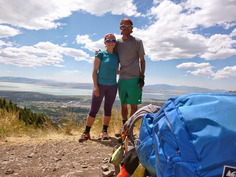
We climbed up a game trail from Jess's parents' home up a steep slope to where the official terminus to our route awaited us at the trailhead at the top end of Matterhorn Terrace of Summit Park.

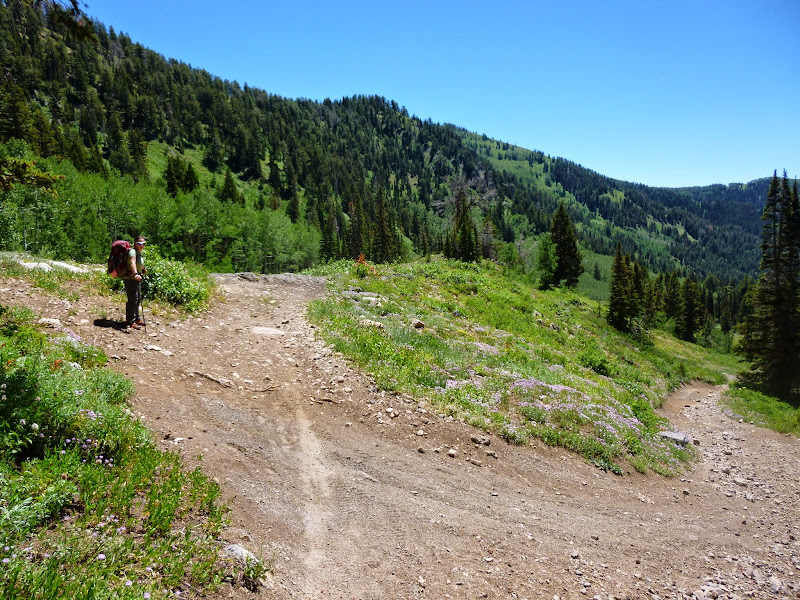
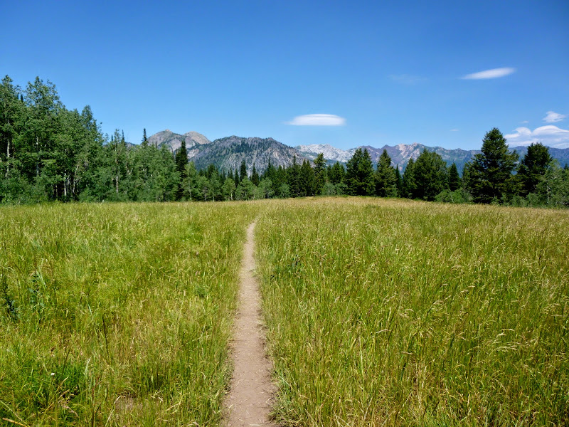
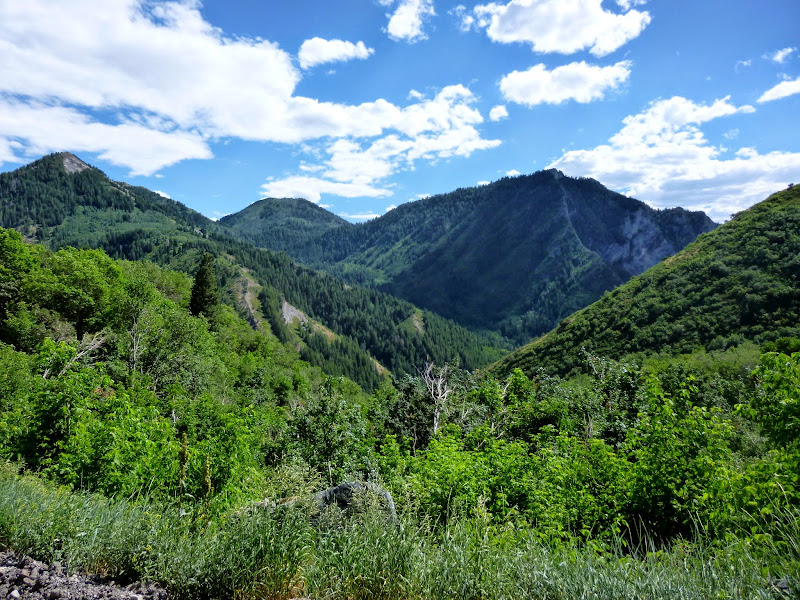
We would take the Over Easy trail, not to be confused with Easy Over, to the ridge that separates Summit Park from Pinebrook. From there, we'd descend down into Toll Canyon where we encountered much more vegetation than I had last time I had scouted it out. Now the flowers and such were towering over the trail at 5 to 6 feet tall and soaked us with morning dew. We felt like we were walking through a rain forest for a good stretch and it wasn't long before the cold morning dew was felt by our feet through our shoes. After a few miles, we met up with Lamb's Canyon, cruised through a beautiful stand of aspens, then up the steepest part of the day to the ridge across the top of The Canyons resort and beneath Murdock Peak. There we took the first big break of the day.


From there we traversed down the east side of Murdock Peak and joined the Wasatch Crest Trail.

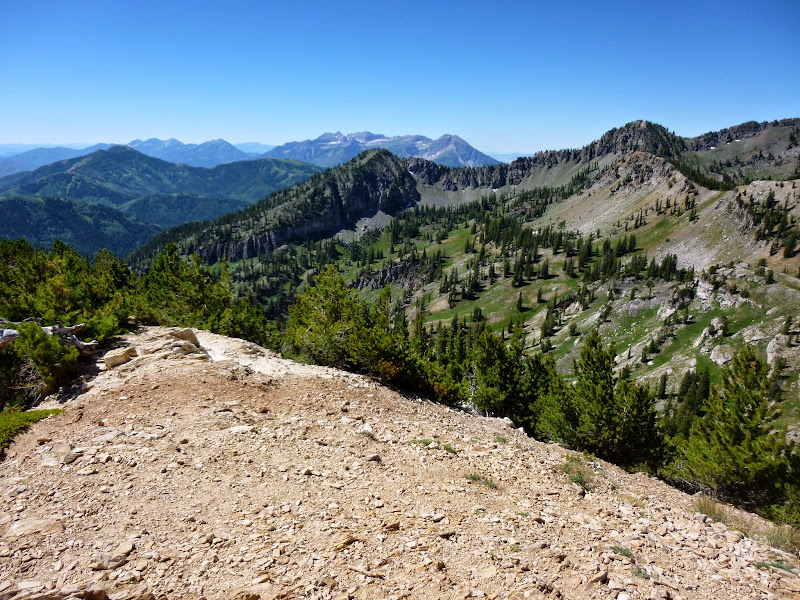
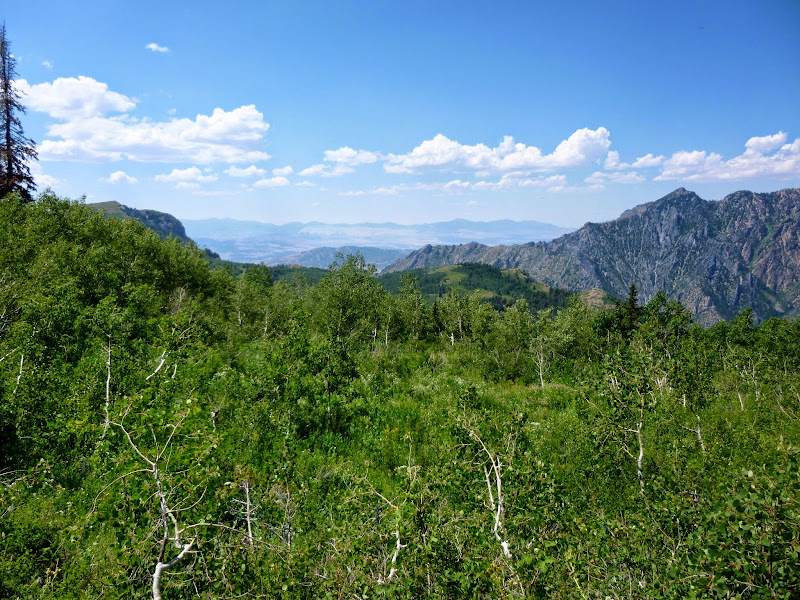
We followed the WCT to Scott's Pass, just short of Guardsman Pass. Along the way, we'd pause at Desolation Lake. We'd also enjoy fantastic views down into Park City, Big Cottonwood Canyon, Salt Lake Valley, flowers galore, and the ridge lines of the Wasatch mountains all around. Such views would be common throughout much of the trip.


We had hoped to reach Brighton before 3 to have lunch at their little cafe knowing that they shut down their grill at that time. It was about 12:30 when we left Lake Desolation, so we left hastily for Brighton from there.


We reached the bottom of "Puke Hill" that feeds down into the Scott's Pass trail at about 2:15. We charged down hill before hitting the lower switchbacks of Guardsman Pass Road. Once we reached the toilet facilities there on the side of the road, we took a shortcut and bushwhacked down to the main road leading up into Brighton. By then it was about quarter to 3, and I called up the cafe to place an order. Two of their western style burgers would be waiting for us as we arrived at just 5 minutes to 3.


We bought some drinks and candy and feasted on our burgers and fries. We then took about another hour just kicking up our feet and airing out our shoes and socks in an attempt to get them a little drier. At 4:30 we put our packs back on and set off on the last mile and half or so to Lake Mary, taking a gander at Dog Lake along the way.


Once at Lake Mary, we found that it was surrounded by dozens of teenagers engaging in some cliff jumping and swimming, despite all the "no swimming" signs posted all around. Luckily they were all there just for the day. I had planned on a site I found on previous hike up there with our family back in June, and felt fortunate to find that it was vacant. It was well secluded from the main trail between Lake Mary and Martha.


- Day 2 -
Tuesday - July 22, 2014
Tuesday - July 22, 2014
Miles hiked: 11.5, Total Miles: 27.5


After breakfast, we packed up camp and set off for Catherine Pass once again, this time with our packs. We stopped just below Lake Catherine to filter some water from a small spring that crossed the trail and topped off all of our water bottles (5.25 liters total), knowing that it would be a good long stretch thereafter before we'd reach our next water source. Save the night before, this would be the only time we'd use a filter on water, and yet I questioned if we really needed to use it at this spot because it appeared to be a legitimate spring coming right out of the mountain on the side of the trail and the water was as cold and clear as it could be.
We paid another brief visit to Lake Catherine along the way and even stumbled upon an acquaintance from a snow-shoeing activity we participated in back in January. After re-acquainting ourselves, we got up to the pass where we dropped our packs and set off for a quick little side trip up to Sunset Peak. Though already getting later in the day, the views were well worth it!


By the time we had enough of the view and got back to our packs, it was already after noon and we had covered a little over a mile from our camp. So, once again, we made haste, and made the long descent down into American Fork Canyon. Once down, it was time to go up again as we caught trail #157 up to the ridge that would lead us along the eastern edges of AF Canyon for several miles. Once we reached the ridge, about 1:30, we paused for a lunch break. While having lunch, two dirt bikers stopped by to say hi before they continued on down into Big Flat.


With lunch finished, we began the long route along #157. The views would again be awesome with sights of Heber Valley and the Uintas on one side and AF Canyon, Timp, Box Elder, and the southern ridges of Little Cottonwood all on the other side. We'd see signs we were entering bear country and Jess found an egg sitting on the side of the trail.


We paid another brief visit to Lake Catherine along the way and even stumbled upon an acquaintance from a snow-shoeing activity we participated in back in January. After re-acquainting ourselves, we got up to the pass where we dropped our packs and set off for a quick little side trip up to Sunset Peak. Though already getting later in the day, the views were well worth it!


The miles would begin to add up and heat began to take a toll however. When we reached a point right above Forest Lake, we found ourselves very low on water with still a mile and half to our next water source, Rock Spring. It was now about 5 pm and at this point I began to feel quite nauseous and woozy. We had just passed the turn off down to Forest Lake and I considered dropping down the half mile or so to filter water there, nasty as it looked, but it would be a steep hike back up.
Instead, we pulled over in some shade just off the side of the trail, where I sat down across the trail and mixed in some gatorade into the last 10 ounces of water I had and sipped at it. Jess insisted she was feeling fine and offered up the last 10 ounces of water she had. I would slowly sip on this water and splashed the last couple ounces across my head, face, and neck. I also took in a couple pieces of candy. After about a half hour, the nausea had gone away and I felt ready to press on for Rock Spring. It was a scary experience, and just as scary hiking with absolutely no water and fingers crossed that Rock Spring would prove reliable.

After a long mile and half, we eventually reached Rock Spring. As if manna from Heaven, we began to fill our bottles and camel up.

Refreshed, and full of water, we were ready to make our way on to Mill Canyon Spring. This would be where our original planned camp for the night was to be, but we had decided earlier in the day to try and get a few extra miles behind us and push on for Salamander Flat before dark.

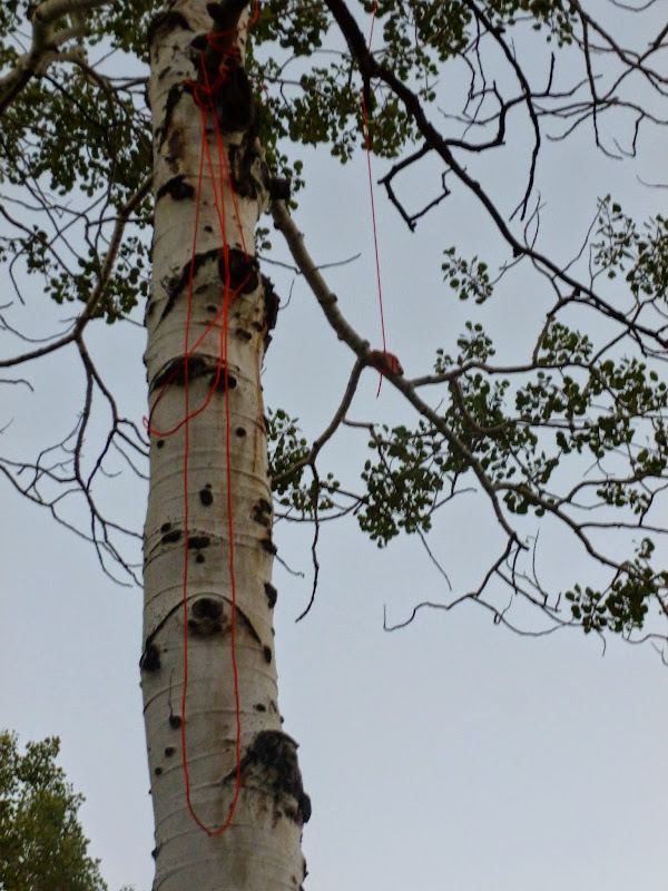
Along the way, there was a tree that beckoned for a photo op. I don't condone random scratching into trees like this, but since the deed had already been done...

Well, despite our maps and itinerary stating that it was only another 1.5 miles from Rock Spring to Mill Canyon Spring before another 4 more miles to Salamander, we found that the trail from Rock Spring led us in an entirely different direction from what the maps showed. After what should have been a mile and half, it looked like the area for Mill Canyon Spring was some distance away. Growing a bit frustrated, we continued on, expecting to arrive any moment. It would be another good hour before we'd finally set foot into the Mill Canyon Spring area. Right as we entered, we looked right and saw what appeared to be a trail at one point had now been closed off with dozens of logs laid across it as far as one could see.

Apparently the mapped trail is an old trail that has since been closed off, which would have been a more direct route from Rock Spring. Instead, it seems that there has now been a new trail created, with a few long switchbacks, that I can only guess adds a couple more miles of distance from Rock Spring based on the time it took us to reach Mill Canyon Spring.
At the edge of exhaustion and with only an hour of good light left at this point, we decided to call it and make camp at Mill Canyon Spring, as originally planned.

For a funny little side story, I failed miserably to get a successful bear hang up and ready. I like to use the PCT method and have had success with it before, but for whatever reason, I didn't pack enough rocks into my little rock pouch to get the other end of my rope to fall all the way over the other side of the branch of the tree I selected and the rope wedged itself stuck. Every attempt to free the rope thereafter only made it worse until I ended up with a rope knotted up all over the tree and it became a lost cause.
Fortunately, we had our food stored in some odor proof bags I had ordered from litetrail.com, mainly to keep food smells from leaching onto our pack's fabric and other contents. With no other choice, we left our food bags unsecured in our packs within sight of our tent. I figured if the odor proof bags didn't do well enough, and a bear still came sniffing around in our camp, I'd be able to see it from the tent and run after it with some noise makers and/or call out for help knowing we had a couple neighboring us a few hundred feet below our camp and a scout troop that had settled in right across from us just after we had set up our camp.

To our relief, we were able to sleep a restful night and woke up to our packs and food being untouched. Wanting to make up some extra miles, we opted to eat breakfast on the go and got a start on the trail by 7:30 am.
We finished off #157 onward to Salamander Flat. Morning light lit up the east face of Timp and at one point, appeared majestic as it rose up in a brilliant panoramic view. Unfortunately my camera could only capture a trace of the beautiful picture that stood before us.


By about 10 am, we reached Salamander Flat where Jess was happy to have a proper toilet…well, a proper pit toilet, if you can even use the word proper here. Afterwards, she commented that perhaps the open air outdoors was better indeed. I'd concur. We had a quick mid-morning snack and then hiked another mile on up to Timpooneke trailhead where we'd make a longer pit stop.


Once at Timpooneke, we checked our feet, treated them for some hot spots, and had another snack. We also topped off our water from the tap there, knowing that it'd be another 8 miles to our next water source, Indian Springs above Grove Creek. After a good rest, we pushed on at about 11 am.


The 8 mile stretch to Indian Spring was mostly wooded. After being spoiled by such wide open and beautiful views the first two days, we couldn't complain since the tree cover we found ourselves hiking through provided welcome shade for much of the way. Midway through, we pulled over for another rest and some lunch. Except for the first day, lunch every day would essentially consist of a couple of tortillas with peanut butter, some Fritos on the side, and any other appetizing snack from the day's snack pack.


At about 3 pm, we got our first clear glimpses of Utah Valley. Its nickname, Happy Valley, now makes more sense to me as it made us both very happy to see it.


At about 4 pm, we arrived at Indian Springs. We finished off our remaining water, and took a good long rest. As was the case with Rock Spring, and even Mill Canyon Spring, Indian Springs does not disappoint. Drinking from it on a hot summer's afternoon is like drinking the nectar of gods. So cold, so refreshing. We camelled up again, and took down some gatorade mixed into an ice cold water bottle to ensure optimal hydration. We also mixed up another bottle of Propel to have on the miles ahead.


I had originally planned in what was to be my solo trip to just go another mile up into Chris Flat and hang my hammock in a nice stand of Aspens there. However, making camp there would leave a very long 23 mile day for the last day. Not wanting to punish Jess nor myself with such a day, we felt very good about making day 3 a much longer day to shorten up the final day. We really wanted to try to make it down into Provo Canyon and hope to find a spot in the Nunn's Park Campground, but decided that if we even made it that far, it'd be pretty late and with Pioneer Day being the next day, there was a good chance all the sites would be full. So, we compromised and picked a site a bit up from Provo Canyon known as Rock Pile Monument. This is not a site I'd recommend for camping, if it can be avoided, since it is a junction with about 5 different trails that receive a lot of mountain bike and trail runner traffic. But for our purposes it would have to do.
It was about 5:30 pm when we had put our packs back on to leave Indian Spring, and just after soaking our bandannas in the cold water to help keep us cool, a little shower decided it wanted to help in the cause and sprinkle us with a bit of rain. Some afternoon thunder clouds were starting to build up now and we wondered if we'd be able to safely make it up and over Baldy Pass without the threat of lightning. Having heard no thunder or seeing any flashes of lightning yet, we felt good. That, and there were plenty of trees up both sides of the switchbacks we'd be hiking up to the pass that if we ever did hear thunder, we'd rush to the nearest thicket of trees and take shelter until it seemed safe again.

Once we came out on Chris Flat, it was obvious that another group had already laid claim to the site I had originally planned to camp. Luckily, with our new plan to move on, we weren't so disappointed. We safely made it up Baldy Pass by 7 pm with plenty of cloud cover and some pleasant sprinkles of rain, but no lightning. I had hoped to squeeze in a side hike to Big Baldy from the pass, but due to time, it would have to wait for another day.


Once over the pass, we'd set eyes on Provo and the area of our neighborhood for the first time of the trip. We took in the view for a moment and then pressed on the last 3 miles or so down to Rock Pile. While it was mostly all downhill, it still felt like a long 3 miles. This was probably due to it being late in the day and the fact we had already hiked a good 17+ miles upon reaching the pass.


At last, we made it to Rock Pile Monument. There wasn't really any level ground to pitch our tent, so we had to settle for the most level spot I could find, right across the trail from the rock pile. It still proved to be a good slope though. By now the sun was setting and I figured there'd be few others, if any, crossing through the area through the rest of the night. We enjoyed dinner with a view of the city lights in the valley and the glitter of fireworks from those celebrating the eve of Pioneer Day.


Right as we were about to settle into our tent, at about 10:30pm, we heard some voices and saw some lights coming down through some trees across the meadow. Then suddenly, we were greeted to a parade of 5 trail runners making their way on to down to Provo Canyon and/or the valley.
After getting settled in, I was startled from my sleep, when again at about midnight, another couple of trail runners dashed past our tent. Fortunately, the rest of the night would be spent resting to the sound of light showers dancing atop our tent.
When I awoke the next morning, it was just in time to catch a partial rainbow touching down into the valley. I felt privileged to see it.


Did I mention that the site we were at receives a lot of trail traffic? Not long after awaking, an occasional runner, biker, or hiker would pass by every several minutes. No matter. I let Jess sleep in a little bit before the final push for home, while I continued to take in the rainbow and the fresh morning air.
Once Jess was up, we packed up and took our breakfast to go again. Right before descending into Provo Canyon, I wanted to go explore an area just off the trail we were on that allegedly had some boulders containing some petroglyphs. It didn't take me long to find what indeed appeared to be some old and weathered petroglyphs while Jess rested on the trail below.


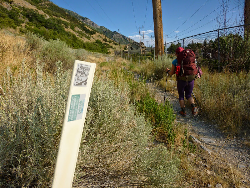
After having my fun with the petroglyphs discovery, we dropped down into Canyon Glen Park in Provo Canyon where again, Jess was thrilled to catch a proper restroom, and I was thrilled to reach yet another water source that would not need any time spent filtering. Apparently there was a raft and run race taking place at that time and we found ourselves in the middle of it as we pushed our way up to Nunn's Park and on to Bridal Veil Falls. We'd top off our water bottles here, take in the falls for a few moments, sit for a snack, and then press on up the Bonneville Shoreline Trail until it reached Pole Canyon.


Instead, we pulled over in some shade just off the side of the trail, where I sat down across the trail and mixed in some gatorade into the last 10 ounces of water I had and sipped at it. Jess insisted she was feeling fine and offered up the last 10 ounces of water she had. I would slowly sip on this water and splashed the last couple ounces across my head, face, and neck. I also took in a couple pieces of candy. After about a half hour, the nausea had gone away and I felt ready to press on for Rock Spring. It was a scary experience, and just as scary hiking with absolutely no water and fingers crossed that Rock Spring would prove reliable.


At the edge of exhaustion and with only an hour of good light left at this point, we decided to call it and make camp at Mill Canyon Spring, as originally planned.


- Day 3 -
Wednesday - July 23, 2014
Wednesday - July 23, 2014
Miles hiked: 20, Total Miles: 47.5
To our relief, we were able to sleep a restful night and woke up to our packs and food being untouched. Wanting to make up some extra miles, we opted to eat breakfast on the go and got a start on the trail by 7:30 am.
We finished off #157 onward to Salamander Flat. Morning light lit up the east face of Timp and at one point, appeared majestic as it rose up in a brilliant panoramic view. Unfortunately my camera could only capture a trace of the beautiful picture that stood before us.


It was about 5:30 pm when we had put our packs back on to leave Indian Spring, and just after soaking our bandannas in the cold water to help keep us cool, a little shower decided it wanted to help in the cause and sprinkle us with a bit of rain. Some afternoon thunder clouds were starting to build up now and we wondered if we'd be able to safely make it up and over Baldy Pass without the threat of lightning. Having heard no thunder or seeing any flashes of lightning yet, we felt good. That, and there were plenty of trees up both sides of the switchbacks we'd be hiking up to the pass that if we ever did hear thunder, we'd rush to the nearest thicket of trees and take shelter until it seemed safe again.


After getting settled in, I was startled from my sleep, when again at about midnight, another couple of trail runners dashed past our tent. Fortunately, the rest of the night would be spent resting to the sound of light showers dancing atop our tent.
- Day 4 -
Thursday - July 24, 2014
Thursday - July 24, 2014
Miles hiked: 18, Total Miles: 65
When I awoke the next morning, it was just in time to catch a partial rainbow touching down into the valley. I felt privileged to see it.


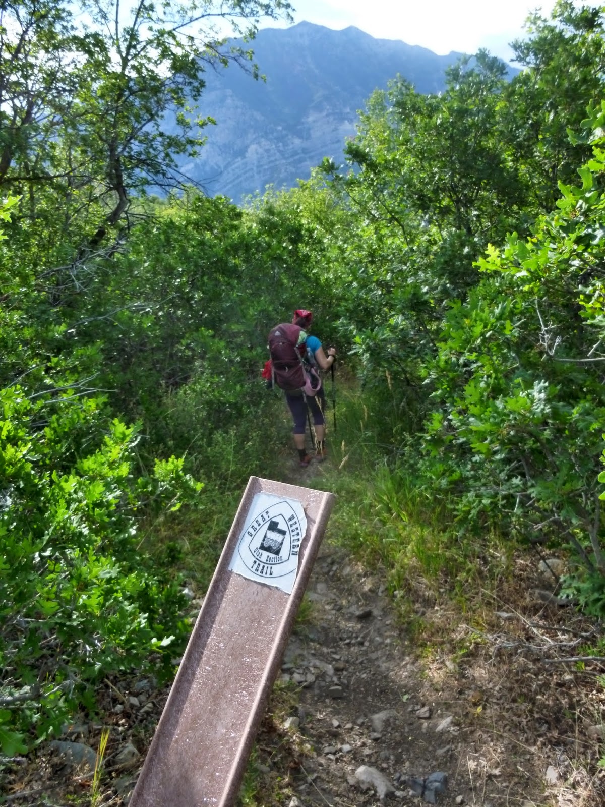


Once we reached Pole Canyon we turned up its trail and pushed our way up to Hope Campground where we'd take another rest. I knew Pole Canyon would be a good steep hike, but little did I know that it would be so thick with weeds full of sticky seeds this time of year. It obviously wasn't well traveled, despite connecting into an established campground.


Unfortunately, all the taps at Hope Campground were all sealed off so we couldn't top off our bottles, but luckily we didn't have to rely on water being available there. After a good break and de-seeding ourselves, we made our way up to Little Rock Overlook. Of course, that would result in more meadows full of sticky weeds and seeds.
At last we were clear of the meadows of weeds and reached Little Rock Overlook where we were able to take in yet another fantastic view in just about all directions.


By now it was about 3:30 pm and we still had a good few miles to go before we'd be descending through Rock Canyon and the final few miles to home. So on we went.
I had also hoped to squeeze in a summit of Buffalo Peak since it would only be about a quarter mile off our route, but again, due to time, it too would have to wait for another day. We crested the high point of the day right below Buffalo and began to make our way down to Rock Canyon.


When we reached a lookout with the Squaw Peak Road down into Rock Canyon, there was a family out with some scopes monitoring a small fire that had apparently been started by lightning during the previous night. Luckily for us, it was high up, and did not pose any threat to the trail far below. A helicopter could be seen dropping loads of water on it.


After watching that for a couple minutes, we continued on down the road. We could have opted to cut across the road and keep to the trail we were on to get us further down the road and avoid some switchbacks the road takes, but since our feet were feeling pretty beat up now and our water again was running a bit low at this point, we opted to stay the road to make it a bit easier on our feet with the more gradual slope it offered and in case we underestimated our water needs and needed to seek a bit of extra water from any passers by.


At last we were clear of the meadows of weeds and reached Little Rock Overlook where we were able to take in yet another fantastic view in just about all directions.


I had also hoped to squeeze in a summit of Buffalo Peak since it would only be about a quarter mile off our route, but again, due to time, it too would have to wait for another day. We crested the high point of the day right below Buffalo and began to make our way down to Rock Canyon.


Fortunately we reached Rock Canyon Campground without incident and took a brief break to have another snack and finish off the last of our water. There was no tap available at this campground either, but I knew that we would strike a wonderful little water fountain not more than a mile down from the campground along the trail.


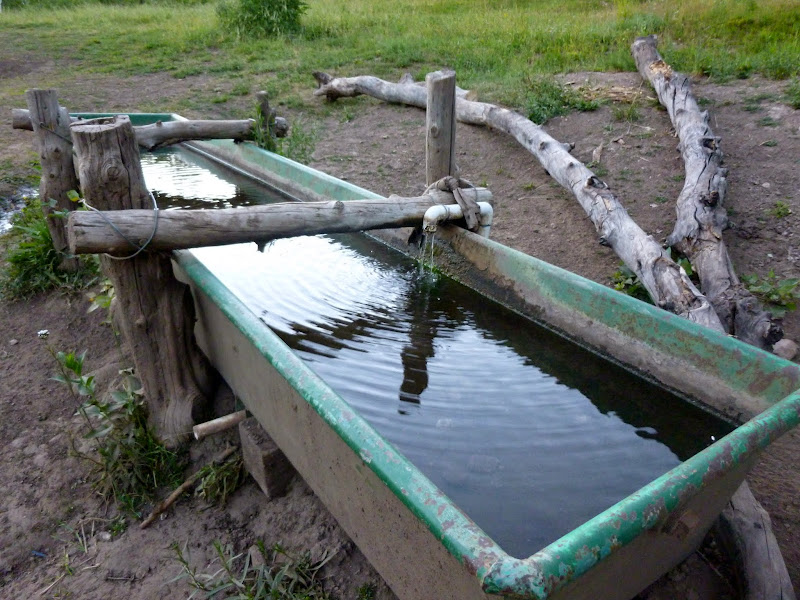
And wonderful was that fountain indeed. We did not top off here since I knew there would yet be another similar fountain along the trail shortly before exiting the canyon. It would be there that we would top off our bottles and soak ourselves and bandannas to prepare for the brutal heat that would await us along the last stretch of the Bonneville Shoreline we'd be taking to home. Before we reached the final fountain, we enjoyed the sights of various rock formations, caves, and other features of Rock Canyon.


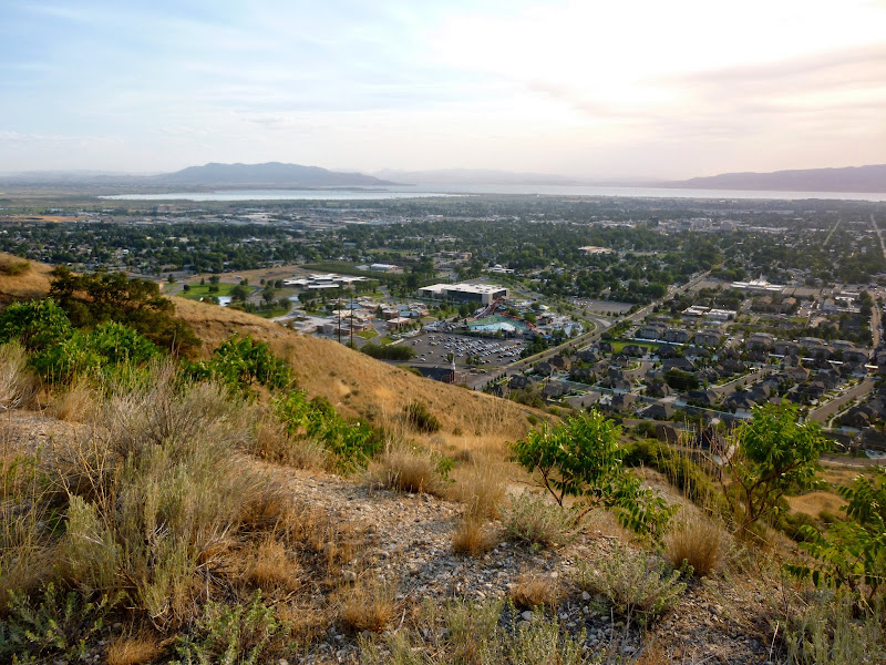
After having our fun with that final fountain, we exited the canyon and made haste for home. Once back out on the Bonneville Shoreline Trail, our home was now closer than ever. The views were terrific once again as we raced against the sun.


We could have carried a bit less water out of Rock Canyon, knowing we'd be passing by the trailhead for Y Mountain where there would yet again be another water fountain, but in the interest of time we were feeling great with the ice cold water we had already obtained from Rock Canyon. While it was still quite warm out, the peak heat of the day had passed, and Y Mountain marked the final checkpoint of the trip with about 2 miles to go.


As we passed above our home, we were able to look down and see Jess's mom waiting with our kids, looking up and waving as we waved back. We were really missing our kids at this point and couldn't wait to finish out the last mile to get back to them. We rushed on down to the mouth of Slate Canyon and its trailhead as quick as our bruised and battered feet would let us before turning back into the valley.


From here it was a short walk down and across the road before we could turn into our neighborhood and arrive at the curb of our home at last. It was now 8 pm.

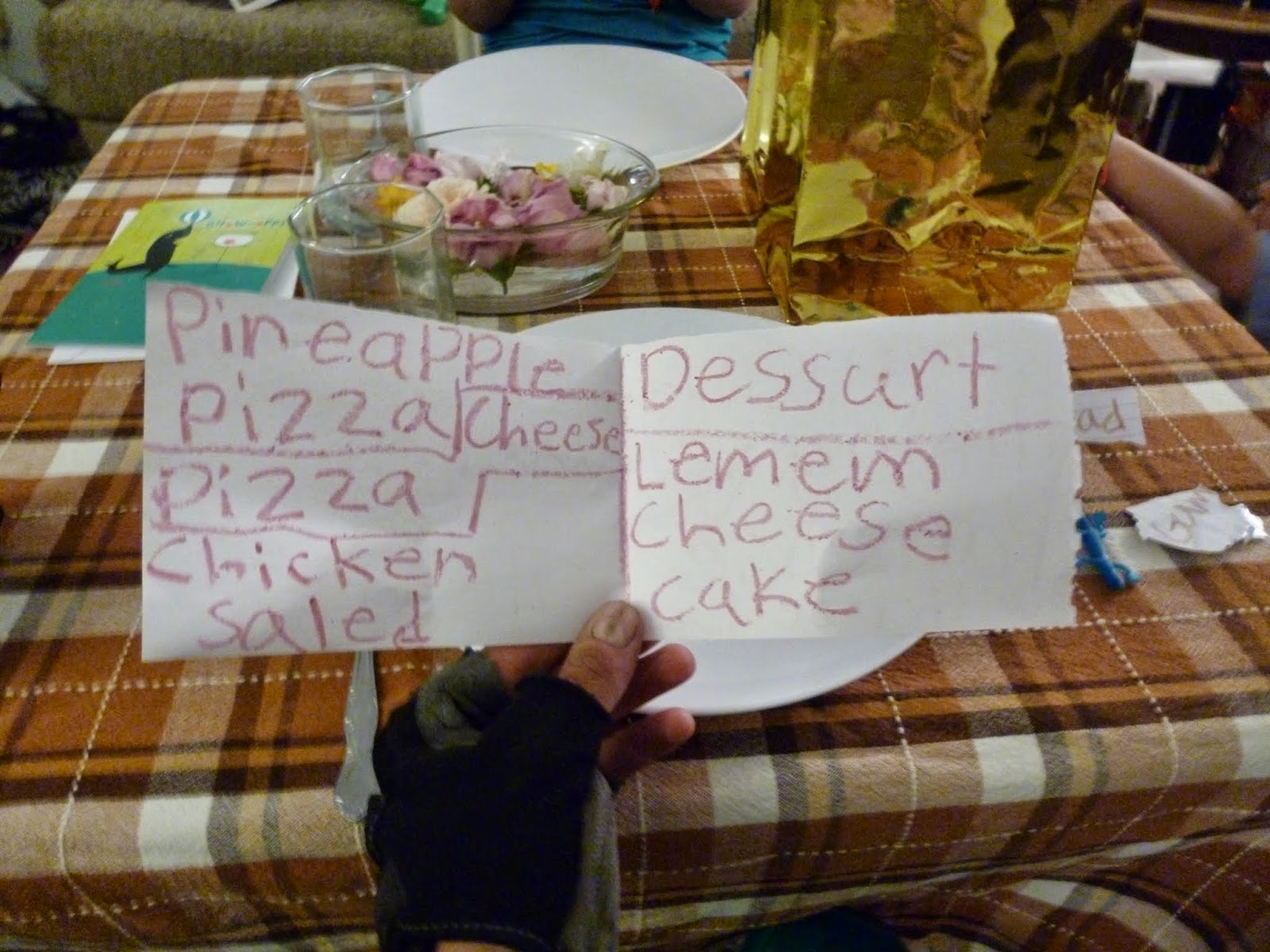
It was an exciting and emotional moment to see our two youngest run toward us with arms outstretched to embrace us. Meanwhile, our two oldest were finishing off the final touches on a surprise restaurant they had made up for us where they would serve us up a meal of pizza, salad, soda, and cheesecake and provide us with gifts of body wash, shampoo, and lotion. I'm not sure if the gifts were simply a thoughtful gesture or a polite hint to shower and wash up ASAP. :-D


The day and the trip couldn't have ended any better.
For the full Flickr photo set, click here.


For the full Flickr photo set, click here.


That is incredible! What a memorable adventure!
ReplyDeleteAwesome, what a great adventure! Alicia @ www.girlonahike.com
ReplyDeleteI have been looking for a trip in the Wasatch for 2017 and this sounds like a good one to do. are there any maps or guides to this area that you recommend?
ReplyDeleteAny other multiday backpacks you recommend?
There's a lot of variation you can do with this route, particularly with starting and ending points. If you're creative, you can also loop together some other trails through the Wasatch for a multi-day adventure. Since virtually all trails in the Wasatch are typically done as day hikes or overnight backpacking trips, there are some great books out there that treat the trails as such, but there aren't any I know of that would be all that useful in really guiding you through a multi-day backpacking trip. My recommendation would be to just look over some maps such as National Geographic Trails Illustrated series (Wasatch North and Wasatch South), measure some mileage and see what looks most appealing for the amount of time you have. For example, some variations that could be made to my route would be to go up into Timpanogos Basin and spend a night and summit that mountain then finish off down at Sundance if you could afford to treat yourself to a stay at the resort there or you could start at Mill Creek Canyon out of Salt Lake and go up to the Wasatch Crest Trail from there, then over to the Brighton Lakes, then take Catherine pass down into Little Cottonwood Canyon where you could take Cardiff Pass back into Big Cottonwood and then up and over back into Mill Creek Canyon for a big loop that could be done as a multi-day trip. You could also use much of my route and start further north and finish further south, or visa versa, to make it a longer trip. Or, better yet, the nearby Uintas Range offers some great multi-day possibilities as well. I recently did most of the Highline Trail up there and will be posting trip reports on that soon.
Delete